Report Summary
Highlights of key results for Tolko's Southern Operating Area.

Preliminary Assessment
The Alberta Biodiversity Monitoring Institute (ABMI) measures and reports on the state of biodiversity and human footprint across Alberta. This report is a preliminary assessment of the status of land cover and biodiversity in Tolko Industries Ltd.'s (Tolko's) Southern Operating Area in Alberta.
This information establishes baseline conditions for several indicators of land cover and biodiversity which can be used to measure long-term forest health and inform current and future adaptive management strategies in the Southern Operating Area.
Area of Analysis
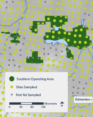
- The Southern Operating Area covers approximately 13,890 km2 of north-central Alberta, representing 25% of Tolko’s total operating area in Alberta.
- Tolko shares management of this land base with West Fraser Mills Ltd. and Vanderwell Contractors (1971) Ltd.
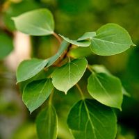
- In this region, Tolko predominately harvests deciduous species (Trembling Aspen, Balsam Poplar). Incidental harvest of coniferous trees is passed along to other permit holders.
Methods
The ABMI has 34 permanent monitoring sites in Tolko's Southern Operating Area; data have been collected at 26 of these sites as of 2021. At each location, ABMI technicians recorded the species present, and measured a variety of habitat characteristics.
The ABMI also measured human footprint using fine-resolution aerial photography and satellite imagery at two spatial scales. Detailed assessment of human footprint was completed using a 3 × 7 km area around each of the 34 permanent monitoring sites in 1950, 1980, and between 1999 and 2021. A broad assessment of human footprint was also conducted using a wall-to-wall human footprint map for the entire province circa 2021. Land cover and species data were used to assess the status of a number of indicators.
Chapter 2 Highlights: Land Cover Status & Trend
Introduction and Overview
Documenting and mapping vegetation types over time is critical to understanding how human activity, including forestry, is affecting ecosystems, and to supporting sustainable, evidence-based land-use decisions.
In Chapter 2 of this report, we summarize status and trend for land cover indicators for Tolko's Southern Operating Area:
- We summarize the current human footprint and native vegetation in the Southern Operating Area, and how these have changed since 1950. We examine the most recent decades in more detail, presenting information on how human footprint, natural disturbance, and aging of undisturbed forest have changed vegetation types between 2000 and 2021, and particularly between 2010 and 2021.
- We also present the change in average stand age between 2010 and 2021, as well as how the widespread fires in the summer of 2023 contributed to changes in land cover and stand age.
- Finally, we summarize current conditions and the change in the amount of interior habitat—native vegetation that is away from human footprint—and current linear footprint, which may occupy small areas directly but has a larger impact on interior habitat than other forms of human footprint.
Key land cover results are shown below.
Status of Human Footprint and Native Vegetation
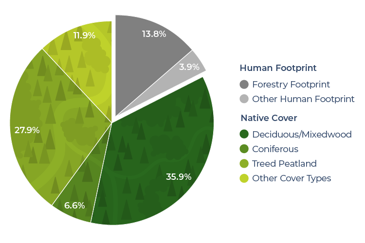
As of 2021, total human footprint was found to be 17.7% in Tolko's Southern Operating Area.
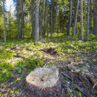
- Forestry was the largest human footprint, representing 13.8% of human footprint in the region.
- Energy footprint (2.4%) was the next most common footprint type in the Southern Operating Area, with the remaining footprint types each covering less than 1.0% of the region.
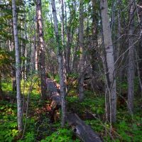
As of 2021, undisturbed native vegetation covered 82.3% of the Southern Operating Area.
- Undisturbed upland stand types, where forest harvest takes place, covered 42.5% of the land base.
- This includes deciduous (26.2%), mixedwood (9.7%), pine (3.4%), and White Spruce (3.2%).
Trend in Human Footprint and Native Vegetation
The total area of human footprint in the Southern Operating Area increased by 8.0 percentage points, from 9.7% to 17.7%, between 2000 and 2021.
- The largest increase was in forestry footprint, which increased by 7.8 percentage points during this timeframe, from 6.0% to 13.8%.
- When recovery of harvested areas over time is taken into account, the effective forestry footprint increased by 4.6 percentage points, from 4.8% to 9.4%.
The change in vegetation cover between 2000 and 2021 varied according to stand type and age.
- The area of deciduous stands decreased the most, by 2.9 percentage points, from 29.1% of the land base to 26.2%.
- The area of mixedwood stands—the next most common upland forest type in the region—decreased by 2.5 percentage points, from 12.2% to 9.7%.
- In old (>120 years) stands, deciduous and mixedwood stands both increased in area. Deciduous stands increased by 1.2 percentage points, from 0.9% to 2.1%, and mixedwood stands increased by 0.7 percentage points, from 2.4% to 3.1%.
Detailed Land Base Change from 2010 to 2021
We looked in more detail at how land base changes due to human footprint and fire, as well as the aging of undisturbed forest, affected the distribution of vegetation types in Tolko's Southern Operating Area between 2010 and 2021.
- Human footprint and fire disturbed 12.1% of native vegetation. The most affected types were White Spruce (20%) and mixedwood stands (22%).
- Fire alone contributed 4–6% of the disturbance in upland stands.
- Large areas of deciduous and mixedwood stands aged beyond 120 years, with small areas reaching that age in White Spruce and pine stands.
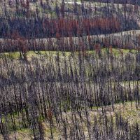
Effects of the 2023 Wildfires
Widespread fires in the summer of 2023 altered land bases across Alberta. We used preliminary fire mapping to show how those fires affected Tolko's Southern Operating Area.
- 8.8% of the total land base burned.
- Depending on forest type, 7–13% of upland (coniferous and deciduous) forest burned.
- Depending on forest type, 11–20% of old (>120 years) forest burned.
- Depending on forest type and age, 9–12% of previously harvested areas burned.
Change in Average Stand Age
We present average stand age as a broad indicator of change in the forested land base, directly relevant to many species and to forest management. The average stand age in Tolko's Southern Operating Area decreased between 2010 and 2021, and following the 2023 fires, as follows:
- Average stand age decreased from 77 years in 2010 to 76 years in 2021. Most of this decrease was due to forestry.
- The 2023 fires brought the average stand age down significantly, to 70 years, with comparable declines across stand types.
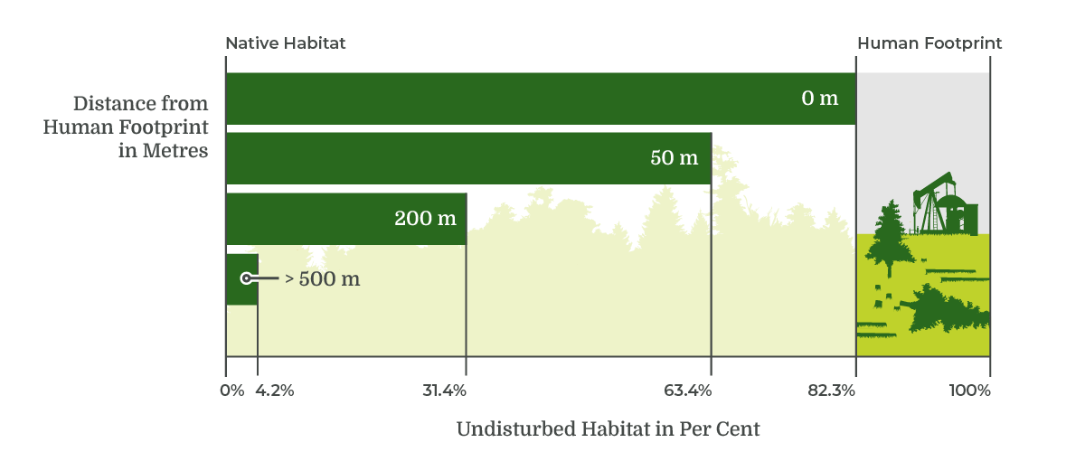
Native Habitat Status and Trend
Human footprint can have effects beyond the area it occupies. We summarized current conditions and change over recent time in interior habitat—the area of native vegetation types removed from human footprint. Native habitat—82.3% of Tolko's Southern Operating Area as of 2021—decreased with distance from human footprint and time as follows:
- At 50 m, 200 m and 500 m away from human footprint, interior native habitat was 63.4%, 31.4%, and 4.2%, respectively, in 2021.
- The distribution of linear footprint was the primary factor reducing the area of interior habitat between 2010 and 2021.
- Between 2010 and 2021, 6.5% of native vegetation was converted to human footprint. White Spruce and mixedwood stands were the vegetation types most affected by human footprint in this timeframe.
Status of Linear Features
Being widespread, linear footprint has a large effect on the amount of interior habitat in the region. As of 2021, the linear footprint density in Tolko's Southern Operating Area was:
- 3.3 km/km2 for all linear feature types combined.
- 2.6 km/km2 for conventional seismic lines, representing 79% of line types.
- 0.4 km/km2 for roads, representing 12% of line types.
- 0.3 km/km2 for pipelines, representing 9% of line types.
Chapter 3 Highlights: Status of Biodiversity
Introduction and Overview
Identifying species most affected by land-use changes is essential for effective land-use planning and developing targeted mitigation strategies when needed. However, with multiple industries operating within the same area, isolating the specific impacts of each industry on various species can be challenging. Additionally, natural disturbances, particularly wildfires, further alter habitats and complicate the understanding of species' responses.
In Chapter 3 of this report, we report on how human footprint and other land base changes impact the habitat suitability for species in the Southern Operating Area:
- The Biodiversity Intactness Index is used to summarize the overall effects of human footprint on the habitat suitability of species in the region.
- To understand how different human activities are impacting habitat suitability, we summarize the local and regional effects of different types of human footprint (i.e., energy, forestry, transportation, and urban/industrial) on habitat suitability for species.
- Finally, we examine how human footprint, natural disturbance, and aging of undisturbed forest affected habitat suitability for species in the Southern Operating Area between 2010 and 2021.
Key results for biodiversity are shown below.
Status of Overall Biodiversity
The ABMI assessed the status (current condition) of 647 species in Tolko's Southern Operating Area and found the Biodiversity Intactness Index to be, on average, 92%.
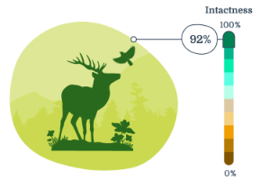
Average intactness for each taxonomic group was:
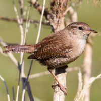
Birds
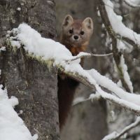
Mammals
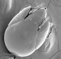
Soil Mites
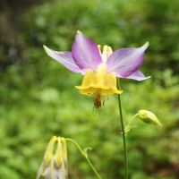
Vascular Plants
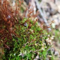
Mosses
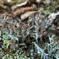
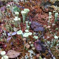
Lichens
Effects of Human Footprint on Habitat Suitability
Habitat suitability was lower within human footprint compared to the native vegetation it replaced for ~59% of species across six taxonomic groups within Tolko’s Southern Operating Area. Lichens and mosses were the most negatively affected by human footprint, while other species groups, particularly birds and vascular plants, exhibited a broader range of responses to different sectors. Forestry resulted in stronger negative effects on species reliant on old, upland forest stands. All sectors increase habitat suitability for species associated with open and/or disturbed habitat. Sectors such as energy and transportation have reduced impact at the regional scale because of their smaller footprint.
Effects of Land Base Change on Habitat Suitability
Effects on habitat suitability were assessed for different types of land base change in Tolko’s Southern Operating Area: forestry, non-forestry human footprint, fire, and aging of undisturbed stands. The net effect of natural changes was greater than the net effect of human footprint; fire and aging had substantial effects on most taxonomic groups. New forestry footprint reduced habitat suitability for 66% of species. This was partially offset by aging of older harvested areas.
Chapter 4 Highlights: Species of Management Interest
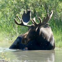
Status of Moose
Density, habitat associations, and predicted effects of land base change on Moose are presented. Moose density was 0.29 individuals/km2 in Tolko’s Southern Operating Area. Moose are predicted to benefit from the increased quantity of young browse created by forestry activities in the region. The combined effects of land base changes (e.g., human footprint, fire, forest aging) in the Southern Operating Area are predicted to have minimal impacts on habitat suitability for moose.
Tracking the Recovery of Woodland Caribou Habitat
Results from a recent study examining habitat recovery for Woodland Caribou are highlighted. Remote sensing tools were used to track vegetation regrowth along seismic lines in Woodland Caribou ranges. Results showed that vegetation is recovering faster in harvested areas compared to other disturbance types. Overall, the study provides a method to distinguish between areas that are regenerating naturally and those that need restoration to support regrowth.

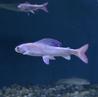
Species Spotlight: Arctic Grayling
Management concerns for and status of Arctic Grayling (ranked as May Be At Risk in Alberta) in Tolko’s Southern Operating Area are highlighted. Arctic Grayling migrate between three major habitat types throughout their lifespan, moving between feeding habitat, overwintering habitat and spawning habitat. Disturbances that impact Arctic Grayling habitat include roads, forest cutblocks, pipelines, and seismic lines. Arctic Grayling abundance has decreased from historic levels within Tolko's Southern Operating Area.
Species of Conservation Concern
69 designated species of conservation concern were detected in Tolko’s Southern Operating Area. Of these, 12 are federally or provincially listed or recommended for listing as Endangered, Threatened, or Special Concern. Of the 34 species that were common enough to allow for the calculation of intactness scores, habitat suitability was reduced as a result of human footprint for 65% of species (70% to 98% intact), and improved for 24% of species (74% to 99% intact).
.jpg)
Status of Non-native Vascular Plants
31 non-native vascular plant species were detected in Tolko’s Southern Operating Area. Of these, six species are designated as noxious weeds under Alberta’s Weed Control Act: Creeping Thistle, which was detected at 19.4% of sampled sites, Perennial Sow Thistle (19.4%), Scentless Chamomile (12.9%), Tall Buttercup (6.5%), Common Tansy (6.5%), and White Campion (3.2%). Non-native species were detected at 51.6% of sites, with an average of 3.5 species per site.